
Meteorologist Ray Stagich
WLS Weather Forecast
Monday, July13th, 2015
FLASH FLOOD WATCH IS IN EFFECT FROM 1AM MONDAY THROUGH LATE MONDAY NIGHT.
SEVERE THUNDERSTORM WATCH OUTLINE UPDATE FOR WS 408
NWS STORM PREDICTION CENTER NORMAN OK
410 AM CDT MON JUL 13 2015
SEVERE THUNDERSTORM WATCH 408 IS IN EFFECT UNTIL 1000 AM CDT FOR THE FOLLOWING LOCATIONS IL. ILLINOIS COUNTIES INCLUDED ARE:
BOONE BUREAU CARROLL
COOK DE KALB DUPAGE
GRUNDY JO DAVIESS KANE
KENDALL LAKE LA SALLE
LEE MCHENRY OGLE
PUTNAM STEPHENSON WHITESIDE
WILL WINNEBAGO
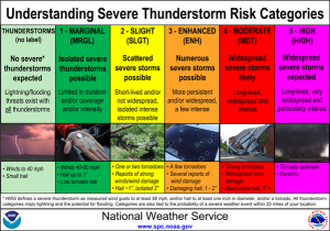
2 ROUNDS OF POTENTIALLY SEVERE STORMS. THE FIRST INTO PARTS OF MONDAY MORNING; THE SECOND ROUND MONDAY AFTERNOON/EVENING.
LARGE HAIL, DAMAGING WINDS, FLASH FLOODING POSSIBLE IN BOTH THESE EVENTS. ISOLATED TORNADOES ALSO POSSIBLE DURING THE PM HOURS MONDAY.
More storms possbile on Tuesday…..
SUNRISE AND SUNSET
JULY 13 2015 – SUNRISE 5:28 AM CDT SUNSET 8:27 PM CDT
JULY 14 2015 – SUNRISE 5:28 AM CDT SUNSET 8:26 PM CDT
Today | Strong thunderstorms likely. Damaging winds and large hail with some storms. Heavy rain coming in two rounds….one in the morning and one this afternoon. High 88F. Winds SSW at 10 to 15 mph. Chance of rain 100%. Rainfall near an inch. With locally higher totals.
Tonight | Partly to mostly cloudy skies with scattered thunderstorms during the evening. A few storms may be severe. Low 69F. Winds WSW at 10 to 15 mph. Chance of rain 60%.
Tomorrow | Scattered thunderstorms in the morning becoming more widespread in the afternoon. High 81F. Winds NNW at 10 to 15 mph. Chance of rain 80%.
Tomorrow night | A few clouds. Low around 60F. Winds NNE at 10 to 15 mph.
Wednesday | A few clouds. Highs in the mid 70s and lows in the upper 50s.
Thursday | Mix of sun and clouds. Highs in the low 80s and lows in the mid 60s.
Friday | Scattered thunderstorms. Highs in the mid 80s and lows in the upper 60s.