Forecast Summary
Meteorologist Ken Boone
WLS-AM
WINTER WEATHER ADVISORY REMAINS IN EFFECT THROUGH 1 PM TODAY.
A LAKE EFFECT SNOW WATCH IN EFFECT FROM TONIGHT THROUGH TUESDAY AFTERNOON.
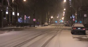
ADDITIONAL ACCUMULATION IS LIKELY DUE TO LAKE ENHANCEMENT THROUGH TUESDAY. BE CAREFUL ON THE COMMUTE TO WORK AND SCHOOL TO BEGIN THE WEEK.
Today | Snow this morning will transition to snow showers this afternoon. High 32F. Winds E at 10 to 20 mph. Chance of snow 80%. Snow accumulating 1 to 3 inches.
Tonight | Snow showers early, with a steadier snow developing late. Low 23F. Winds NNE at 10 to 20 mph. Chance of snow 90%. 1 to 3 inches of snow expected.
Tomorrow | Snow during the morning will taper off as a few snow showers during the afternoon. High around 25F. Winds N at 15 to 25 mph. Chance of snow 70%. 1 to 3 inches of snow expected. Winds could occasionally gust over 40 mph.
Tomorrow night | Clear to partly cloudy. A few flurries are possible. Low 14F. Winds NNW at 10 to 20 mph.
Wednesday | Sunshine. Highs in the low 30s and lows in the mid teens.
Thursday | Mostly sunny. Highs in the upper 30s and lows in the upper 20s.
Friday | Rain and freezing rain. Highs in the mid-40s and lows in the low 30s.